M-DAB2: Material intensity of inner development - resource assessment and localization of urban development potentials
Short Description
Background and Motivation
The annual land consumption in Austria exceeds 42 square kilometers (approximately the area of Eisenstadt) and thus significantly exceeds the target value of 9 km² per annum aimed for by the year 2030 in the current government program (Umweltbundesamt, 2021 and BKA, 2019). The ongoing sprawl not only increases the land consumption for buildings but also significantly raises the demand for land and primary resources due to the need for new infrastructure for transportation, supply, and disposal. The targeted development of existing urban areas ("inward development", Grams, 2017) reduces annual land consumption and has great potential to decrease the use of primary resources. To identify and evaluate suitable potential areas, various factors (e.g., location, existing and targeted building densities, or the capacities and qualities of existing infrastructure) must be considered. However, the quantities of construction and demolition materials and related environmental impacts are not currently considered in the urban planning evaluation of inward development potentials.
Objectives
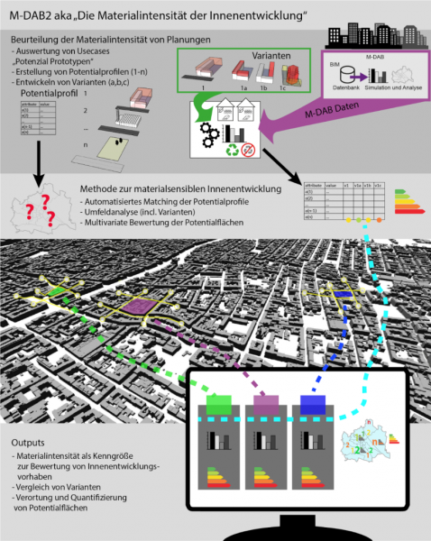
The project pursues the goal of localizing, qualifying, and quantifying potentials for inward development, and, for the first time, should also make the material intensity of inward development (material turnover) assessable for different development scenarios, both from a developer's and a city-wide perspective. The development of the criteria and verification with GIS-supported, automated environmental analysis allows for the comparison of different scenarios (e.g., demolition & new construction, additions, conversions & refurbishment) depending on the respective environment, forming the basis for a systematic optimization of site planning.
Methodology
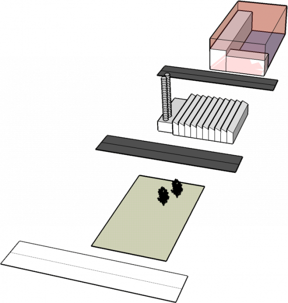
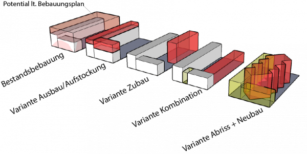
The approach is exemplarily tested in the project by using five different spatial situations typical for Vienna. To determine area and usage potentials in these "profiles", three development variants are elaborated using specific test designs. These designs demonstrate concrete possibilities for urban planning in the area of inward development for existing areas. The required components and materials can be determined from the resulting BIM models, and thus be subjected to an ecological and economic evaluation. Using the indicators, which are converted into potential profiles through qualitative and quantitative analyses of specific potential areas (potential prototypes including development variants), patterns can be identified – based on the expanded data foundation of the predecessor project M-DAB (FFG No. 873569) and by using digital methods (e.g., machine learning) – in order to automatically localize and quantify similar potentials in the city. Interactive visualization makes the potentials visible using different filters and weighting criteria, with the results also being examined from the perspective of different target groups.
Results and Conclusions
M-DAB2 develops a digitally supported model for assessing the material intensity of inward development potentials and an interactive visualization of results, making these potentials assessable from both a developer's and a city-wide perspective. For the first time, the material intensity for development variants such as attic expansions, extensions, and demolition and new construction becomes assessable. In the interdisciplinary research project, each individual work package – such as the development of qualitative profiles, the identification of indicators and attributes for the renovation and refurbishment variants, or the ecological evaluation – already contributes to sustainable inward development. However, it is only possible by combining the different methods and the extrapolation of data – incorporated into intelligent, interactive visualizations – that a more holistic, clearer picture of urban strategies for environmentally and economically sustainable development of Vienna can be drawn.
Outlook
Urban planning and architecture, intertwined with densification and sustainable development, enable the identification of unused spatial and material potentials and promote densification while preserving existing built space. With the developed model of material intensity, planners and real estate developers can generate development scenarios for construction projects beyond "Common Practice" (demolition and new construction) and develop optimized concepts regarding land and material resources.
Project Partners
Project management
TU Wien - Institut of Spatial Planning, Research Unit of Local Planning / Spatial Simulation Lab (Simlab)
Project or cooperation partners
- TU Wien - Institute of Water Quality and Resource Management, Research Unit of Waste and Resource Management
- TU Wien - Institute of Architectural Sciences, Research Unit of Digital Architecture and Planning
- Rhomberg Bau GmbH
- Ernst Dengg - DS energie consulting & management GmbH
Contact Address
TU Wien - Institut of Spatial Planning
Research Unit of Local Planning / Spatial Simulation Lab (Simlab)
Karlsgasse 11
A-1040 Vienna
Tel.: +43 (1) 58801 280430
E-mail: stefan.bindreiter@tuwien.ac.at
Web: https://simlab.tuwien.ac.at


